When MS4 systems release water into sensitive or impaired waters, they must meet strict TMDL requirements. MS4 permits require the city, county, or other permittee to conduct expensive water quality monitoring programs in these cases. Cities and counties often address these requirements by collecting grab samples periodically from the receiving waters they discharge into. This method generates data regarding the quality of the receiving waters. Yet it provides limited actionable insights to the municipal stormwater teams, who struggle to isolate the specific contributions of their city from those of the broader watershed. Stormwater managers need clear evaluations of how well stormwater management actions implemented in their town reduce their impact on local receiving waters over time.
To address these inefficiencies and get more from their investments, cities are enhancing their water quality monitoring programs by focusing evaluations at urban outfalls. They are using innovative and affordable sampling methods and expanding the utility of monitoring data with available stormwater accounting tools. This approach gives stormwater managers actionable data. They can assess and track the impact of stormwater management actions in their area. It also helps align monitoring results with MS4 regulatory compliance and community goals for stormwater management. These adjustments make better use of limited local resources. Using the right tools and strategies, cities can learn a lot about their programs, making the most of the monitoring data they are required to collect.
Five Ways to Boost Your ROI
In this blog, we’ll look at five ways to boost the ROI of water quality monitoring programs required under MS4 permits.
- Monitor at Urban Outfalls for Direct Impact Assessment
- Establish Efficiencies in Monitoring with Smart Technology
- Use Modeling to Extend Insights Beyond Monitoring Sites
- Compare Progress to Baseline to Measure the Improvements and Find Opportunities
- Go Beyond Weather Variability to Track Your Program Impacts Over Time
1. Monitor at Urban Outfalls for Direct Impact Assessment
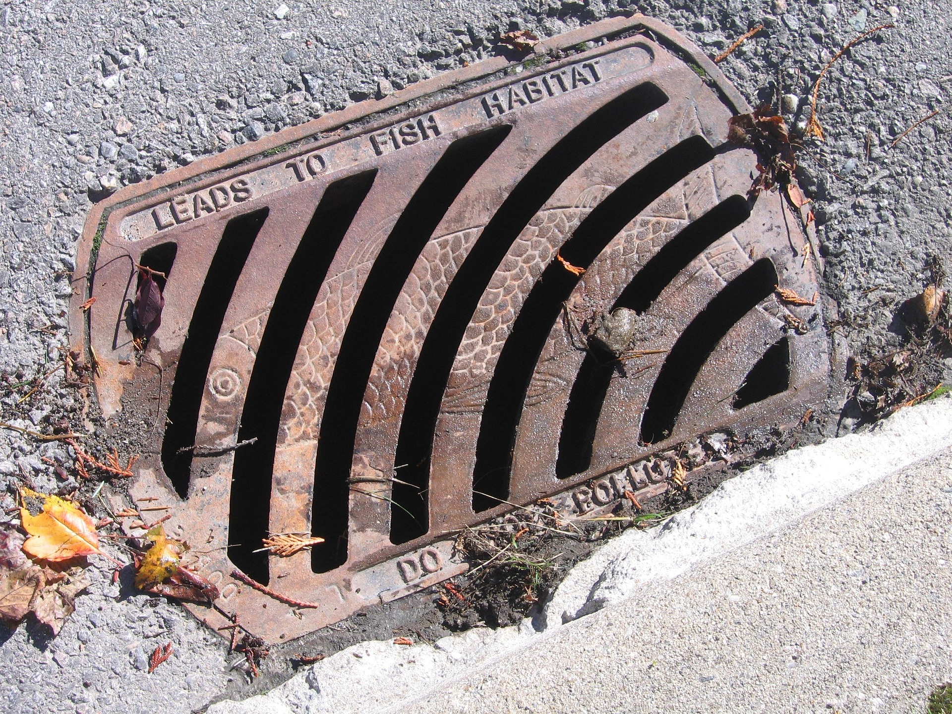
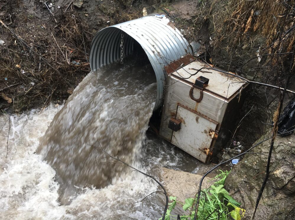
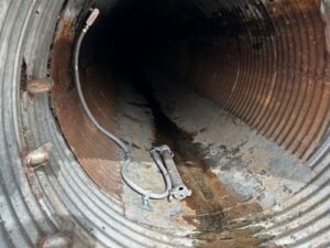
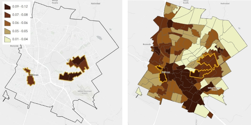
Urban outfalls are where stormwater flows into local receiving waters. Monitoring stormwater quality at outfalls shows how well stormwater management works. These outfalls represent the final discharge point for urban runoff, providing a clear view of the water quality and quantity that urban areas send to local waterways. Monitoring urban outfalls gives key insights into urban runoff and pollutants, like peak flows, annual volumes, and the amount of sediment, nutrients, and other contaminants in their stormwater. Understanding the quality of water discharging from outfalls shows how well urban land management strategies are working or where improvements are needed. If drainages include green infrastructure like rain gardens or permeable pavement, monitoring water quality at the outfalls is key, helping show if these practices reduce stormwater runoff and improve water quality during storms.
2. Establish Efficiencies in Monitoring with Smart Technology
Effective stormwater quality monitoring doesn’t require constant presence, and it doesn’t have to cost a lot. Efficiency is key. Site selection should consider the drainage traits of each outfall. Your chosen sites should include a mix of land uses, sizes, and stormwater conditions. Regular monitoring at key outfalls can track the quality and amount of stormwater discharges from your municipal drainages over time.
Smart Water Samplers offer key insights. The smart technology lets you monitor key outfalls accurately and efficiently. They track water flow rates, pollutant concentrations, and the system’s overall performance. Urban stormwater runoff, the key variable in understanding stormwater quality, can be measured continuously with low-cost stage recorders. Fit-for-purpose sampling designs give precise data. This method yields event, seasonal, and annual volumes and pollutant load estimates, as well as data key for tracking and reporting the impact of stormwater programs.
The ROI of smart technology is clear:
- There’s less time spent forecasting and chasing storms to time sampling visits.
- Field personnel spend less time scooping water in dangerous storm conditions.
- Fewer samples are needed, saving money on costly lab analysis.
Save money while obtaining better data you need to evaluate your stormwater program impact.
3. Use Modeling to Extend Insights Beyond Monitoring Sites
Even with efficient monitoring, it’s impractical to oversee every part of your stormwater system continuously. Adopting advanced models can augment your network by simulating runoff patterns, pollutant loading, and overall system performance. This not only helps fill data gaps but also extends the reach and enhances the value and utility of your monitoring efforts, providing valuable information to areas beyond where you have direct observations.
Choosing the right modeling tools is key. They should offer insights to help manage stormwater systems with maximum efficiency. Can the model provide an accurate representation of your varied city landscape? This is best achieved with a GIS-based modeling framework. Does it require an expert to update model results as conditions change? Can the model estimate stormwater runoff and pollutant loads at specific discharge points, like structural BMP outlets and urban outfalls? Also, can we check these estimates against monitoring data? Can the model use inspection stormwater infrastructure data to help estimate how well specific assets perform in the landscape? Can it find spots where vulnerabilities may not be apparent from monitoring?
The modeling system should be able to estimate annual stormwater quality at specific urban outfalls that can be compared to outfall monitoring data. It should also include the ability to estimate the treatment benefits of stormwater control measures that exist within the drainage. This way, you can align your water quality monitoring with your stormwater impact accounting system. Your agency’s investment in outfall monitoring offers valuable measurements to help fine-tune model assumptions and confirm accuracy. At the same time, modeling provides a broader view of stormwater conditions across your entire MS4 jurisdiction.
4. Compare Progress to Baseline to Measure the Improvements and Find Opportunities
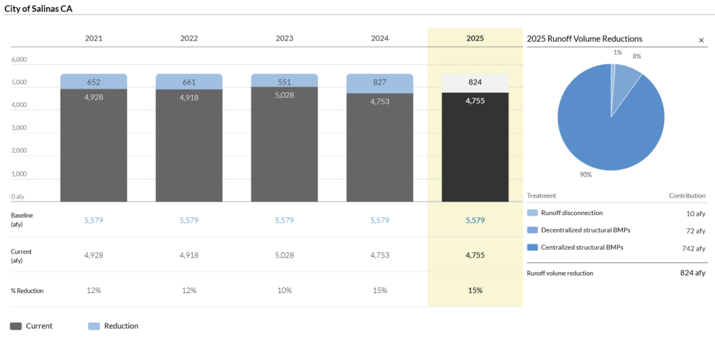
To see how you’re doing and where to improve, compare your performance to a baseline. Baseline modeling assumes no stormwater controls. Monitoring outfalls with ‘untreated’ urban drainages can be used to calibrate baseline model assumptions to fit local conditions. Having a clear baseline helps us understand our progress. By comparing current stormwater management to a baseline scenario of your city without controls, you can assess your progress with clarity and identify areas that still need improvement.
You now have the data and information across your city to determine what feasible volumetric and pollutant load reduction targets and milestones for stormwater improvement can be. Use data from successful local examples to plan what other new investments can pay off. You can plan and monitor progress more effectively by focusing your stormwater program on how your area affects local receiving waters. Many programs note that progress has been made, yet more can be done to manage stormwater as a valuable resource.
5. Go Beyond Weather Variability to Track Your Program Impacts Over Time
It’s important to track your program’s performance over time and predict future results. Weather changes have a significant impact on short-term stormwater runoff. This makes it hard to judge program success after one storm. Seasonal changes, different rainfall patterns, and rare extreme weather can distort monitoring data, making it difficult to determine how well your program is functioning and the true performance of your investments.
Consistent, long-term modeling over a range of weather conditions lessen the impact of natural variability on your performance results. Wet years and big storms generate more runoff and pollution than dry years and small storms. Tracking progress to reduce your city’s impact should include a variety of precipitation patterns. By doing so, you can look past short-term changes and grasp how your system works in different conditions. You can also precisely and reliably quantify, track and report progress as a result of improved infrastructure and better stormwater and land management practices. This long-term perspective helps you identify genuine improvements in urban land management, ensuring an accurate assessment of your program’s positive impact over time.
Conclusion
As cities and counties across the U.S. strive to meet the stringent demands of MS4 permits and TMDLs, a significant opportunity exists to transform routine compliance requirements into powerful tools to inform urban improvements. By adopting these five strategic approaches to water quality monitoring, municipalities can use limited resources better while going beyond mere compliance to actively enhance their urban planning and management strategies. Using accurate data from focused monitoring to improve model estimates helps inform better decisions.
The vision is simple: by carefully considering MS4 monitoring requirements, cities can use data to inform better land management decisions and enhance residents’ quality of life. In this way, the regulations can become catalysts for urban innovation, driving municipalities toward more resilient and vibrant futures.