The flood risk in Yavapai County, AZ is very real. Heavy rain, monsoons, and the remnants of tropical storms can all cause devastating floods, and flash foods are particularly common in the state, crashing down within minutes of a rainstorm. Large scale wildfires are happening more and more often as well; devastating on their own, they also increase the dangers of both flash flooding and mudslides. Since 1981, the Flood Control District of Yavapai County has worked to minimize public and private losses due to flood conditions.
“When I do inspections, I can identify potential flooding problems. I can look at the condition of stormwater infrastructure out there and identify where immediate maintenance is needed. If we fail to keep our stormwater infrastructure properly maintained, we could be faced with unmitigated flood impacts, including property damage and potential loss of life.”
— Tony Angueira, Stormwater Engineer
One tool that Yavapai County uses to fight flooding is stormwater management. Understanding where and how stormwater water moves over the ground in this county is no academic exercise: it is part of a coordinated effort to protect local people, homes, and businesses.
Identify Potential Flooding Problems Early

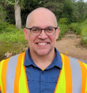
Tony Angueira, Stormwater Engineer, is the individual responsible for this stormwater management, and he takes his job seriously. “When I do inspections, I can identify potential flooding problems,” Tony says. “I can look at the condition of stormwater infrastructure out there and identify where immediate maintenance is needed. If we fail to keep our stormwater infrastructure properly maintained, we could be faced with unmitigated flood impacts, including property damage and potential loss of life.”
This is why, in late 2019, Tony sat down at his computer and started searching for software to help him do his job more effectively. To comply with the MS4 permit, Tony has to inspect and photograph 20% of Yavapai County outfalls every year, in both wet and dry conditions. This requires both organization, to know which outfalls still need inspection each year, and flexibility, so that Tony can get to outfalls during wet conditions.
“The biggest challenge was that we used multiple databases, some of which were housed in other departments, and it was really clunky and complicated. It took a lot of time,” Tony says. “It took a lot of planning to go out and do inspections and make sure I wasn’t hitting places I’d been before.” In addition, “It was hard to respond to weather events when they were occurring.”
Yavapai County is improving their stormwater flood control with 2NFORM
Read case studySoftware for Stormwater Management and Flood Control
Tony found the 2NDNATURE website, and he reached out and started talking to our stormwater experts about 2NFORM, a robust software platform that brings structured data intelligence to MS4 compliance and stormwater management.
“The website looked good. The possibilities were intriguing. Everything they said was just what we really needed to hear,” Tony says. “That’s how it turned out, too.”
Today, Tony uses 2NFORM to manage stormwater across the expansive Yavapai County MS4, and the software not only saves him time and effort — 2NFORM is helping Tony to mitigate flood impacts. “There’s no doubt 2NFORM saves me time,” Tony says. “The ability to add outfalls on a mobile platform, to alter schedules as dictated by conditions, to respond to where weather events are occurring; all of that functionality makes it possible for me to be out there where I have to be, right when the outfalls are flowing. It allows me to be in place, on time to collect samples. I can be at sites where I need a better understanding of how flows occur.” With interactive maps based on Esri’s ArcGIS, Tony can see those outfalls and mark them in the software in real time.
“If I didn’t have 2NFORM, I wouldn’t necessarily be able to analyze all of these things with the same level of fidelity, and I don’t know that anyone else would be either,” Tony says.


