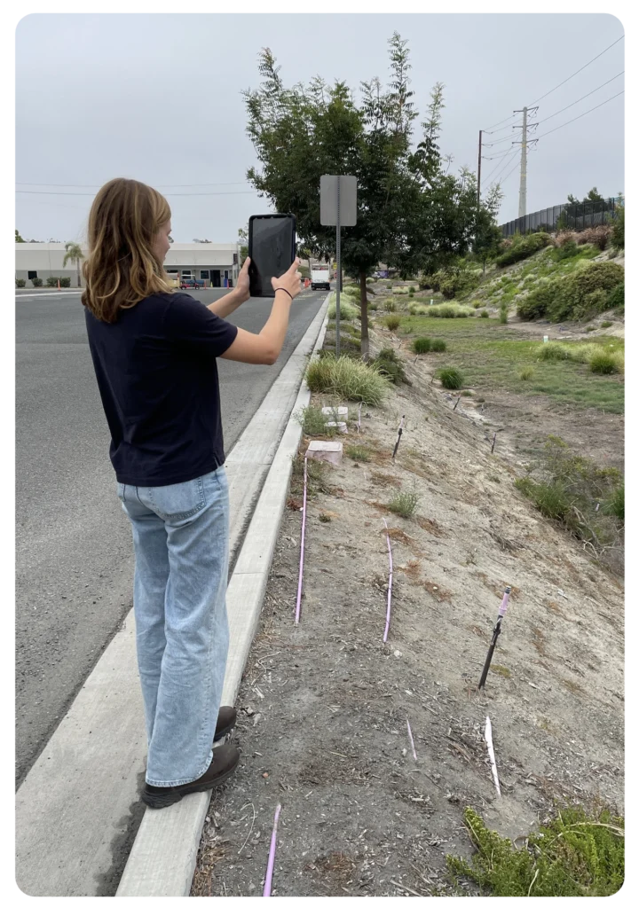
The City of Oceanside (population 170,000) on California’s San Diego Coast faces the dual challenge of managing urban growth while protecting its coastal ecosystems and public health. The City’s Watershed Protection Program aims to meet federal, state, and regional regulatory requirements and advance sustainable practices that keep local watersheds, beaches, and habitats thriving.
Over time, the City’s stormwater team struggled to manage multiple data management systems and sought a tailor-made stormwater program to streamline compliance, free staff for strategic initiatives, and better support long-term resiliency goals.
The Challenge of Legacy Systems
Before adopting new technology, Oceanside managed stormwater data using spreadsheets, MS Access databases, and other tools. By 2023, nine different systems tracked inspections and compliance tasks, creating several issues:
- Manual Processes: Field inspections relied on paper forms and separate photo management. Staff spent hours inputting and reconciling data, leading to excessive additional work, delays, and potential errors.
- Disparate Data Sources: Each compliance program (e.g. Post-Construction Compliance, Industrial and Commercial, Illicit Discharge, etc.) stored data separately. Data from one program can influence and help make decisions on other programs. The siloed data made it difficult for the team to see the bigger picture.
- Complex Training: Frequent staff turnover meant repeatedly training new employees on multiple systems. Convoluted workflows and lengthy standard operating procedures (SOPs) made onboarding take longer and data more prone to mistakes.
- Limited Spatial Insight: Many inspection inventories were not mapped, making it difficult to prioritize inspections, understand drainage patterns, or strategize improvements.
- Time-Consuming Reporting: Annual reports, internal updates, and presentations to regional partners required weeks of compiling and verifying data from various sources.
Watershed Protection staff recognized the old approach was unsustainable. The team needed a single, integrated solution that would streamline compliance tasks and provide actionable insights for long-term watershed management.
Defining the Vision
Oceanside envisioned one centralized platform to manage all stormwater data—easy to use, map-centric, and integrated with existing GIS. With well-organized data, they could reduce time spent on compliance and refocus on proactive strategies. Key requirements emerged:
- Consolidated Data: End reliance on non-stormwater data platforms and reduce number of data platforms.
User-Friendly Interface: Intuitive platform to minimize training time, SOPs, and staff errors. - Map-Centric Assets: Visualize sites, inspections, and assets geographically to prioritize efforts effectively.
Compliance Calendar & Scheduling: Prevent repeated or missed inspections by automating due dates and required follow-up tasks. - Mobile-Ready Forms: Collect data, attach photos, and gather signatures in the field—no more manual data entry back at the office.
- Dashboards & Reporting: Quickly understand progress, pending inspections, and required metrics for annual reports.
- Inter-Departmental Integration: Enable seamless data sharing between departments, consultants, regulators, and partners.
- Future-Focused Compliance: Work with a solution designed to evolve with emerging regulations and ensure long-term resilience.
Selecting 2NFORM
The team considered the potential to collaborate with software vendors the City already contracted with or having the internal GIS team build a custom solution using Esri products like Field Maps and Dashboards. While these options were familiar, they weren’t tailor-made for stormwater compliance and would still demand extensive customization, ongoing GIS support, and supplemental spreadsheets.
Ultimately, Oceanside chose 2NFORM from 2NDNATURE—an integrated, purpose-built stormwater compliance platform designed for California’s MS4 requirements. 2NFORM is connected with the City’s existing Esri-based GIS and meets security and IT standards. This specialized solution aligned perfectly with Oceanside’s needs, offering a ready-made framework rather than starting from scratch.
Smooth Implementation with 2NDNATURE’s Support
The City took a phased approach, initially implementing 2NFORM for three resource-intensive programs: Post-Construction, Industrial and Commercial, and Illicit Discharge Detection and Elimination (IDDE). Oceanside partnered closely with 2NDNATURE’s implementation team, who guided them through data transfers, connecting 2NFORM to the Oceanside ArcGIS system to synchronize data, refining workflows, and training staff. This support eased the transition and ensured the City gained immediate value from its new software.
The shift to 2NFORM yielded immediate benefits:
- Streamlined Compliance and Reporting: Staff recaptured hundreds of hours by automating workflows and consolidating data.
- Enhanced Collaboration: A single, stormwater specific data source—visualized through GIS—allowed all departments, consultants, regulators, and partners to access the same up-to-date information. This improved communication, reduced data discrepancies, and prevented redundant site visits.
- Decisions for the Future: With comprehensive, mapped data at their fingertips, the team can adapt to regulatory changes, prioritize investments, and plan long-term strategies that bolster resilience against flooding and pollution.
The Return on the City’s Investment
Six months after adopting 2NFORM for their Industrial and Commercial Stormwater Compliance program, Oceanside calculated a time savings of approximately 566 hours per year. Similar efficiencies are now being realized across other programs, delivering ongoing cost savings and resource optimization.
“Having all our stormwater data integrated into one geospatial platform has changed the game for us,” says Brittany Perkins, Senior Environmental Specialist. “Using 2NFORM frees up time to focus on proactive strategies—reducing flood risks, targeting maintenance where it’s needed most, and ultimately strengthening our city’s resilience and long-term sustainability.”
A Model for Modern Stormwater Management

Oceanside’s experience underscores the value of embracing integrated, user-friendly technology. The City transformed its program from reactive and time-intensive to proactive and data-driven with a specialized purpose-built solution. The result is an approach that meets today’s MS4 compliance requirements and positions Oceanside to thrive as regulations evolve.
Ready to Take Your Program to the Next Level?
Is your stormwater program ready for a similar transformation? Request a demo of 2NFORM today and discover how you can streamline data management, enhance collaboration, and ensure long-term compliance with ease.


