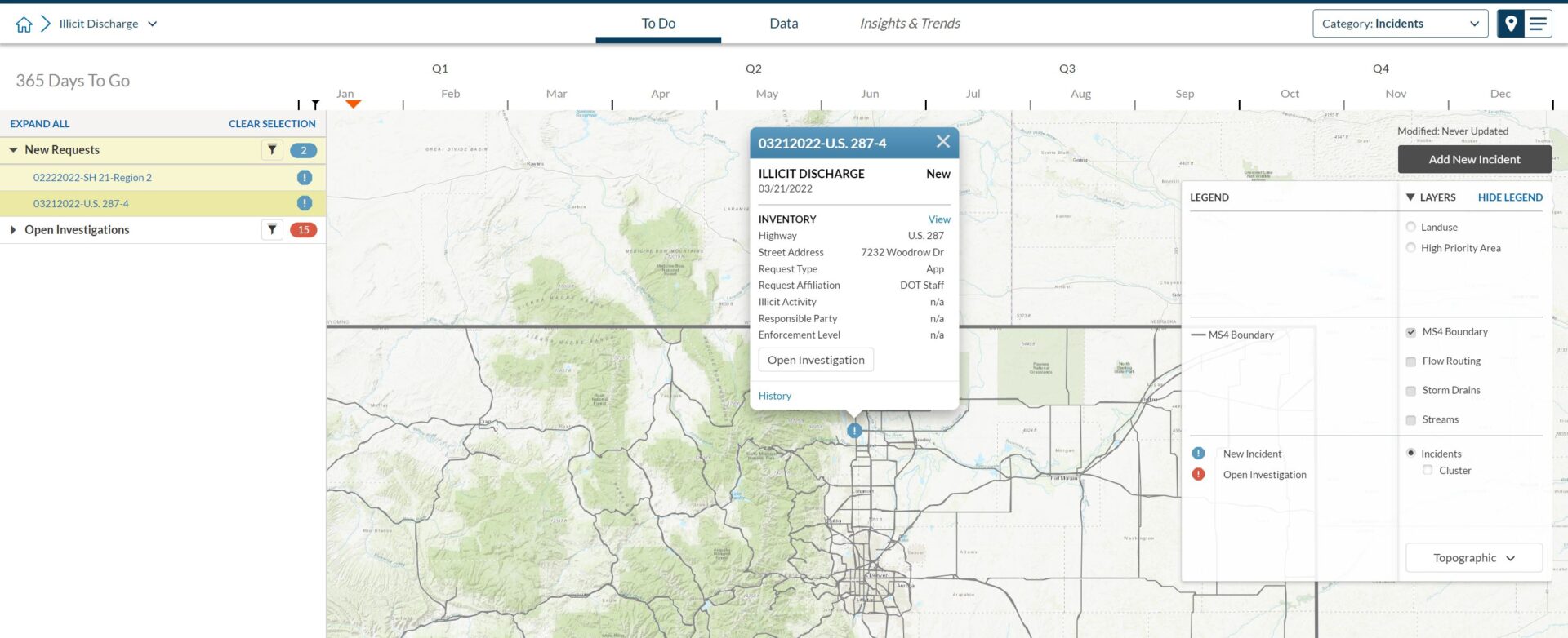
Enable anyone to quickly capture events
Empower staff and the public to capture the location, date, and a photo of an incident.
Automatically schedule new inspections
Reports of illicit discharge automatically trigger an inspection by your staff.
Stay on top of dry weather inspections
Tailor 2NFORM to ensure dry weather outfall inspections are completed in accordance with your MS4 permit.
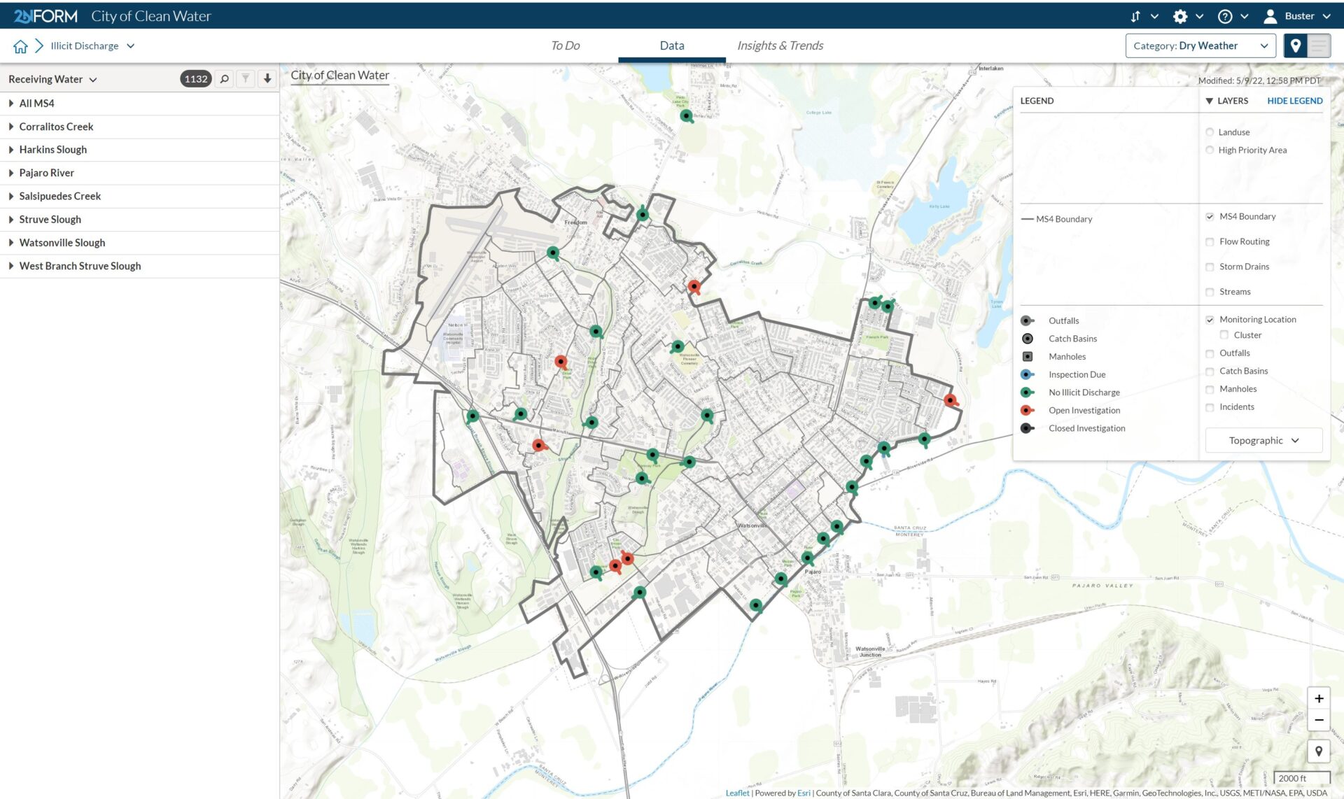
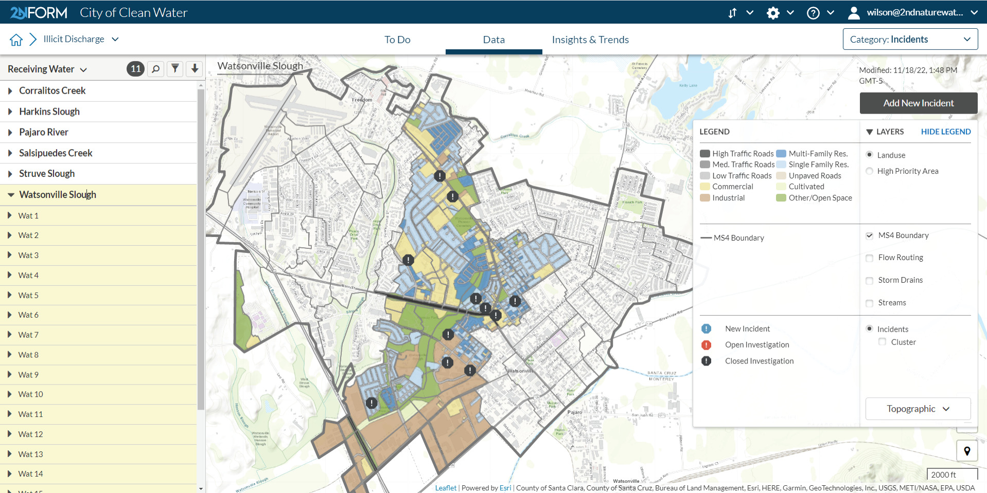
Spot trends and patterns
Dynamic maps and reports help you see common locations and times for illicit discharge and identify repeat offenders.
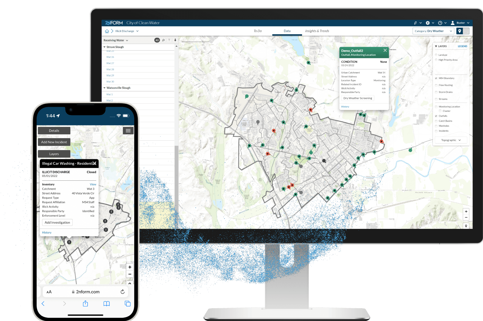
Organize outfalls and illicit discharge inspections
One place to manage it all
Organize dry weather screening at outfalls, record reported incidents, and perform illicit discharge investigations.
Use 2NFORM and your ArcGIS field apps to easily inventory and classify your outfalls.
Organize outfall dry weather inspections to ensure that you meet compliance thresholds.
Built in Capabilities

Streamlined compliance reporting

Intuitive problem solving with GIS

Data-driven insights and trends

Smartphones, not clipboards

Schedule and track work
Streamlined compliance reporting
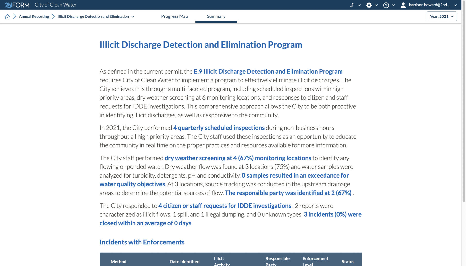
2NFORM streamlines the compilation of your MS4 annual report by summarizing the data your team has collected throughout the year into the relevant section of your permit. The software generates maps, tables and concise narratives populated with program details to summarize program progress and clean water impact of your program efforts.
2NFORM allows you to spend more time on strategic stormwater management and less time reporting to your regulator.

More 2NFORM Modules you may like
Municipal Maintenance Module
Streamline MS4 Good Housekeeping with 2NFORM. Manage assets, track inspections, and automate reporting using GIS for stormwater compliance.
View module
Public Education & Outreach Module
Make clean stormwater solutions actionable to your community
View module
Industrial/ Commercial Module
2NFORM helps MS4 programs manage industrial and commercial compliance. Automate inspections, track data, and prioritize high-risk sites with GIS
View module
Post-Construction Module
2NFORM simplifies post-construction compliance for MS4s. Manage inspections, document assets, and automate reporting with GIS tools.
View moduleLet us help you map a better way
Book a personalized demo to see how our products provide the visibility you need to streamline compliance, achieve your goals, and focus your energy on clean waterways.